

Quinnebaug Trail
Posted By auntie on January 17, 2015
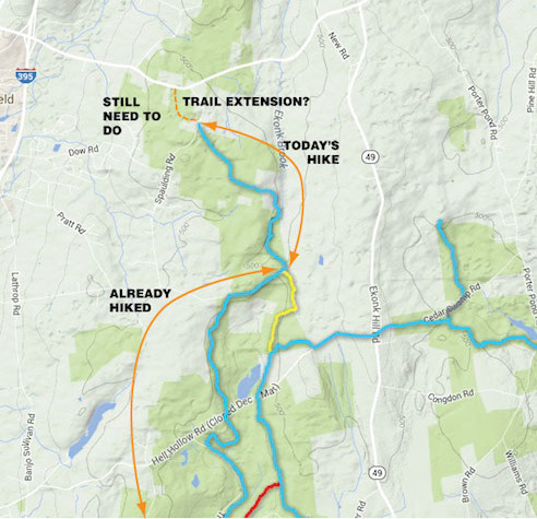
4.76 miles; plainfield, ct
naively thought i’d knock off another blue-blazed trail today, the quinnebaug. i’ve hiked most of it already, i just needed that last bit from flat rock road out to route 14a in sterling. it looked to be about 2-1/2 to 3 miles. “piece of cake,” i thought. “nice way to spend saturday morning.” ha.
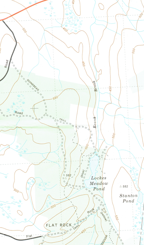
great swamp press map
here’s the area i was planning on hiking. the hubs has already been through here, and he reported a lot of major motorized vehicle activity, which i might have guessed myself, judging by the fact the trail seemed to all be on woods roads. i parked on flat rock road, where the road becomes unpaved, and headed out.
it was very very bad footing for almost the entire trip. all those dirt roads? now sheets of ice. one of my brand new yak trax actually broke. the best part of the trail is at that intersection just below the 550-foot elevation mark near spaulding road (see the map above). it’s at this point that the blue-blazes turn off the roads and head into the woods.
ctfpa map
the connecticut forest and park association map shows the quinnebaug trail ending at spaulding road, but not so! when i got to spaulding road, i saw more blue blazes directly across from me heading back into the woods.
at this point i had been on the trail for an hour and a half, slowly slogging over icy roads filled with rocks, and it was getting late. i had other things i needed to do. my traction device was busted. it was cold. how cold was it? too cold to take pictures. OKAY, OKAY! i wimped out.
i took the road back to my car instead of going into the woods to finish. i am so ashamed. too ashamed to add this hike to the hikefinder. trailhead, trail map

Comments
Leave a Reply