

Airline Trail, Lebanon
Posted By auntie on July 26, 2015
5.81 miles; lebanon, ct
the airline trail state park in connecticut is an old railroad bed that runs from east hampton to thompson, connecticut, in two sections. the southern section is 22 miles long and goes through east hampton, colchester, hebron, and lebanon, and it was this part i visited after my very short walk earlier in the day.
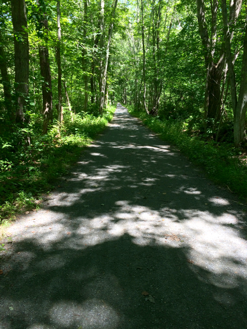
the trail
yep, it all looks like this. level, flat, smooth, and straight. kind of what you’d expect from a former railroad bed. it’s not paved—that’s stone dust. it’s been meticulously maintained, too, and i was passed by dozens of cyclists in both directions. a reminder for this kind of hike: walk on the very far left side of the trail, the way you would on a regular road, facing “traffic.”
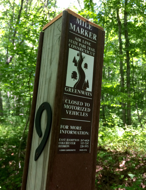
mile marker
it was very nicely marked, too. the only vandalism i saw on these mile marker posts was one post that was at a road crossing, where someone had pried off the numbers (mile 11).
speaking of road crossings, there were quite a few in the short 3-mile* out-and-back i did. all the roads are marked with crosswalks, but you still have to be pretty careful.
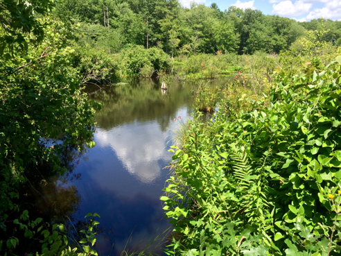
raymond brook swamp
the trail cuts right through a large swamp, and today’s environmental regulations would have never allowed it, but back in the 1860s and 1870s, when the railroad was built, they were obviously quite a bit less stringent about such things, and i can imagine the ecological devastation created by its construction and use. on the other hand, today i get to walk a half mile across a lovely swamp in complete comfort, so there’s trade-offs in everything, i guess.

loosestrife and goldenrod
the loosestrife is winding down and the goldenrod is starting up—summer is flying by. again.

summer sweet, clethra alnifolia
and the summer sweet is just starting up, too. the scent is heavenly.

long view across raymond brook swamp
that lighter area off in the distance you can see is giant reed, or phragmites. i know it’s an invasive, but it really is pretty. there is a spur trail of about 3 miles that runs along the other side of the reeds from colchester and hooks up with the main trail just past the swamp. next time i think i’ll park at the terminus of the spur trail and hike to the main trail and back.
i have added this section of the airline trail to the hikefinder. trailhead, trail map, courtesy the state of connecticut.
*okay, so this is weird. i decided to walk six miles; 3 out and 3 back. so when my gps said i had gone 3 miles, i turned around. total hike distance? 5.81 miles. how is that possible?

Comments
Leave a Reply