

Trails North of Beach Pond
Posted By auntie on September 20, 2016
8 1/2 miles; Voluntown, CT; West Greenwich and Exeter, RI
For anyone familiar with the Rhode Island hiking canon, by which I mean books by Ken Weber and Charles Hickox and Elly Heyder, this hike is listed as one of the most strenuous or difficult in the area. And no one seems to know what to call it, either. Ken Weber calls it Pachaug Trail, but the Pachaug Trail is much more extensive than the small stretch he highlights in his book (Walks and Rambles in Rhode Island, 3rd edition), and not only that, but his hike also includes sections of the white-blazed Canonicus Trail and the yellow-blazed Tippecansett Trail. The Hickox and Heyder book (Walks in the Watershed) lists it as Beach Pond North, which makes a little more sense to me, although it extends pretty far north of Beach Pond. Either way, it’s quite an experience. The two books don’t agree on mileage, either… Walks in the Watershed lists it at 7-1/2 miles, and Weber’s book lists it at 8 miles. I walked it. It was 8-1/2 miles by my iPhone. Oh, and the Connecticut Walk Book East, put out by the Connecticut Forest and Park Association (CPFA) just ignores everything but the actual Pachaug Trail itself, so don’t even bother to look it up there.
Pretty Rugged Climb
It starts (or at least it started for me) at the Beach Pond boat launch at the end of North Shore Road. It very quickly (going clockwise) became tough going. This section of the Pachaug is the wildest and most beautiful section I’ve been on, but there’s a ton of climbing up and down steep granite ridges full of boulders. It reminded me of Long Pond/El Pond, but way more of it. And naturally the day was damp, and the rocks were slippery…

Hemlocks
Like all of the trails surrounding Beach Pond, this hike went through old hemlock forests. There’s something so primeval and atmospheric about hemlock woods… It feels like you’re walking back in time.

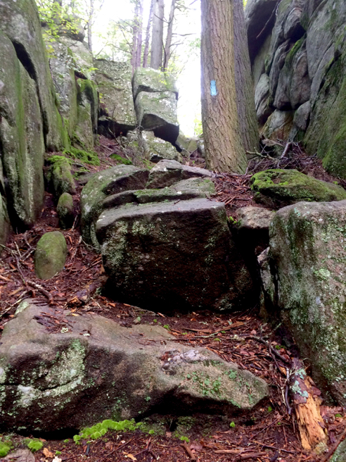
Good Blazing
The blue-blazed Pachaug Trail through here is VERY well marked. In the photo above you can count 4 blazes on 4 consecutive trees. They really don’t want you to miss the trail through here. Also, I kind of got the feeling that this would have been a very damp hike, if we had not been in the throes of a severe drought. Saw a lot of what are considered wetlands plants.

Fascinating Growth
I just really loved how this tree grew to straddle the boulder like a cowboy on horseback.
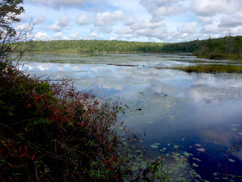
Tippecansett Pond
As I mentioned earlier, this hike is on mostly blazed trails. But once you leave the Pachaug Trail, both the trail blazing and trail conditions quickly deteriorate. The Canonicus Trail, the Tippecansett Trail, and the little unblazed section that skirts Tippecansett Pond have all become obvious four-wheeling routes. They’re heavily eroded and full of ruts, puddles, and rocks. Which is too bad, because they go through some pretty sections of forest. Also, you have to be careful to stay on track here, because there are lots of side trails. But if you squint you can still kind of see the white and yellow blazes. Sometimes.

Trail Junction
Speaking of side trails, I was looking for a trail intersection as I headed south that would be a short cut between the Tippecansett and the Pachaug Trails. Somehow I missed it, and ended up at the junction of the Pachaug and Tippecansett trails not far from Route 165. You could hear the cars and trucks speeding by at this point.

Crossover Trail
Sure enough, here’s the other end of the trail I missed on my way south. No missing it going in this direction.
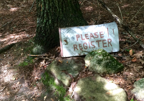
Registration Box
Besides the big signs, in fact, at the base of the tree where the signs were, there was also a registration box.

Trail Registry Entry
I opened it up to sign the trail journal, and what do I find but an entry from my pal Bill A. from the CPFA! This is from the day before we met on the Hell Hollow Loop. “Trails in good shape.” Obviously he hadn’t seen the Quinebaug yet. Oh, and that line about “Saw evidence of a bear on this trail?” If he meant the big dark seed-filled turd I passed earlier on the trail, then yeah, so did I. Eeesh!

Bill’s Route
I got curious about his route, and since I’ve had a few inquiries about backpacking locally, I thought I’d try and plot it out using his trail journal entry. That stop at the Voluntown Peace Trust? He stayed in a yurt. A yurt. How cool is that? And getting access to electricity and showers in the middle of his trip must have been heavenly. See this link for more info. Anyway, this is a great little backpacking trip for anyone who is interested. You wouldn’t have to do the whole 8 days, either. Just remember to contact the Connecticut DEEP for permits.
The end of my hike was very much like the beginning, on the Pachaug Trail, over boulders and down steep rocky ledges. I was VERY relieved to get back to my car. I made a map of my hike.

Comments
Leave a Reply