The Walking Posts

The posts labeled with the little “Truckin’ ” man are from my Walking Journal, which I've been keeping since January 1, 2012. What began as a simple New Year's Resolution to exercise more quickly morphed into a hiking addiction. Below are some running totals.

  MILES TIME ASCENT CALORIES
October 2022 18.06 7h 44m 1399 1463
Year to Date 434.83 194h 24m 32,563 31,433
October Avg. 49.61 24h 19m 508 3,998

Wales Coast Path, Tenby

Posted By on September 20, 2019

Wales Coast Path, Tenby

5.9 miles; Tenby, Wales, UK

Another day another town, and a lovely seaside resort it was! I got off by myself today and put in a nice 6 miles on a Coast Path loop. Would have gone further, but the path was closed due to live fire exercises on the military base that it crosses.

Lotta Love Locks

So many pretty beach views from the main road. I especially loved all the “love locks.”

Jellyfish

Sadly, I don’t think this guy (are these just one guy? or are they a colony?) is going to make it.

Long, Empty Beach

There are two beaches in Tenby, North Beach and South Beach. This is Tenby’s South Beach, and I’m aiming for that headland way in the distance. There’s a loop trail that takes in the whole promontory.

Happy Selfie

I enjoyed my traveling companion, but she really wasn’t able to do the kind of mileage that I preferred, and I was kind of delighted to let her do her historical houses thing while I marched off on my own today. You can tell from that shot, I think.

Ruh-roh…

I had intended to do more mileage along the coast path, but well, whoops. The British military was doing live fire exercises at their reservation and not only were there signs, but there was also a very stern-looking young guard person keeping people away.  So I had to cut my walk short and head inland to make my (now shortened) loop back into town.

Love This Sign!

While this part was road-walking, it was still, as a foreigner, fascinating. I loved this sign!
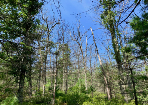
Alternate Route

I was actually walking the alternate route for the Coast Path.

At-Grade RR Crossing

At one point during my journey, I had to cross an at-grade railroad crossing. This was very elaborate, compared to other crossings I’ve made over the years. See almost any Bay Circuit Trail hike, for example!

You can find out more about this stretch of the Wales Coast Path from this website. As always, click the image above for details about this hike and to download the gps track.

Wales Coast Path, Mumbles

Posted By on September 19, 2019

Wales Coast Path, Mumbles

2.6 miles; Mumbles, Wales, UK

We started today from a little churchyard in Mumbles, and walked along a part of the Wales Coast Path. Gorgeous scenery! Hard to match. Well, maybe Cornwall was as spectacular, but certainly not better.

Beach Path Trailhead

This is Rhossili Beach. What a lovely stretch of empty, beautiful sand! I can imagine that during the height of the British holiday season, this is thronging with people, but not today.

Permissive Path

No, a “Permissive Path” is not an “anything goes” path. Permissive paths, sometimes referred to as concessionary paths, are not public rights of way and the public do not have a legal right to use them. They’re more like what we would call in the states an easement.

Coast Path Blaze

At least we were able to find our way to the Coast Path today. It’s not always easy to fine!

Worm’s Head and the Old Coast Guard Station

There is a causeway that goes out to Worm’s Head (the westernmost point of the Gower Peninsula) but we didn’t attempt it because it is only navigable during low tide. From Wikipedia:

The poet Dylan Thomas initially described the Worm’s Head as “the very promontory of depression” and was forced once to spend the night on the Head after being trapped by the tide.

Eeesh!

You can find out more about this part of the Wales Coast Path from this website. As always, click the image above for details about this hike and to download the gps track.

Regicides Trail, Part 2

Posted By on September 7, 2019

Regicides Trail, Part 2

8 miles; New Haven, Hamden, Woodbridge CT

I finally managed to finish this one up! [See this post for part 1.] What an amazing hike. Really loved it, and really felt good the whole way today, too.

Color

Seeing some color on the ground at least, if not in the trees.

Well blazed

I took this little shortcut trail to make shorter loop. See the link to the map, below, that’s on the state’s website.

Nice chicken!

There were plenty of ‘shooms in the woods, and although I didn’t find a hen, I did see this chicken!

City View

This is the view from the overlook of the New Haven skyline, and the ocean beyond.

Bore hole

No idea what this hole was for.

Lake Wintergreen

This picnic/fishing spot was a nice little respite.

You can find out more about West Rock Ridge State Park and the Regicides Trail from this state of CT website (includes a link to the park map). As always, click the image above for details about this hike and to download the gps track.

Hemlock Ledges

Posted By on August 31, 2019

Hemlock Ledges

4.6 miles; Exeter, RI

Today’s hike was with a group of friends. It’s been quite a while since I hiked this iconic RI trail and I forgot how pretty it is. In fact, I decided that I need to get back to this whole trail system at some point.

Nice Photo Opportunity

Nice Photo Opportunity

We had a sunny and warm day, but not too warm. The blue sky really made for nice photo opportunities.

Amanita

Amanita

Lotta nice fungus on this hike. Interestingly, it was an amanita mushroom that kind of sparked my interest in fungus. I remember hiking with my friends Cynthia and Ann… I think we were doing Mount Tom in Arcadia, and we came across this mushroom, and Cynthia said, “Oh. An amanita.” I don’t know why but it had never before occurred to me to attach names to the mushrooms we saw, so I started looking them up. And a mania was born. As to what sparked my interested in edible mushrooms, well, that’s a story for another blog post.

Purple Cort, Cortinarius iodes

Purple Cort, Cortinarius iodes

There were lots of Purple Corts, too. These always look so pretty on the forest floor.

Turkey Tail, Trametes versicolor

Turkey Tail, Trametes versicolor

And of course there was plenty of Turkey Tail.

Dead Hognose Snake

Dead Hognose Snake

This poor little guy got run over. Or something… he was very dead.

Orange Striped Oakworm, Anisota senatoria

Orange Striped Oakworm, Anisota senatoria

And again, there were lots of these guys. But where’s his hookah?

Alas, No Idea

Alas, No Idea

No idea what these guys are, but I thought they were interesting. Like little orange ocean mines or something.

You can find out more about this hike from this page which is part of the excellent David Brierley’s “Story of the Yawgoog Trails.” Includes a link to a trail map. As always, click the image above for details about this hike and to download the gps track.

Hell Hollow Loop

Posted By on August 30, 2019

Hell Hollow Loop

7.5 miles; Voluntown and Sterling, CT

Mileage hike. Um, perhaps I should explain that… See, I’ve been on Weight Watchers for lo, these many months (since the last week of March). And I’ve found that you can get a lot more flexibility in your weekly points allowance when you do a minimum of one really long hike, like I’ve been doing for a while now. So I guess “Mileage Hike” translates to “More Food Hike.”

Anyways, today’s More Food Hike was on parts of two CFPA blue-blazed trails, the Pachaug and the Quinnebaug, and also included the yellow-blazed Pachaug-Quinnebaug Connector Trail.

Pink Ghost Pipes, Monotropa uniflora

Pink Indian Pipes, Monotropa uniflora

I’ve only ever seen white Indian Pipes, and also I didn’t remember that they had a second flush in late summer, so these were a double-surprise. Pretty!

Overgrown!

Overgrown!

The aforementioned yellow-blazed Pachaug-Quinnebaug Connector Trail is badly overgrown and a real mess to hike. I don’t think I’ve ever seen a CFPA trail in such bad shape before. I mean, I knew about how poor the Quinnebaug is to hike on, and kind of expected that. But this was a big surprise.

Didn't Disappoint

Didn’t Disappoint

And here is the Quinnebaug “Trail,” or in this case, brook. It was its usual rock-strewn mess.

White Wood Aster, Eurybia divaricata

White Wood Aster, Eurybia divaricata

There were large swathes of White Wood Aster in places, a plant that makes me happy and sad at the same time. Happy because it’s so lovely, and sad because it means the end of summer.

Phillips Pond

Phillips Pond Picnic Area

The Phillips Pond Picnic Area is the southern end of the Hell Hollow Loop. And the hiking from here back to the parking area by Hell Hollow Pond was very nice (for a change).

Orange Striped Oakworm, Anisota senatoria

Orange Striped Oakworm, Anisota senatoria

I say the hiking was nice, but there were these guys just EVERYWHERE. I mean, after a while (and this sounds horrible of me, but) I stopped trying to avoid stepping on them. There were places on the trail where their frass was just covering the ground. They eat oaks, and while this might be bad for the oaks at some other time of year, by now the leaves are just about to turn anyway, and the feeding doesn’t really do any major damage. And they become such pretty moths! Well, those that don’t get squished by hikers do.

You can find out more about these trails and get a trail map of this part of the Pachaug State Forest from this CT DEEP website. As always, click the image above for details about this hike and to download the gps track.

Wickaboxet and Flintlock Trails

Posted By on August 27, 2019

Wickaboxet and Flintlock Trails

7.5 miles; West Greenwich, RI

My weekly “mileage” hike. Came away from this with very bad back pain for some reason. Could be that I got a new daypack. It’s not any heavier than the old one, but it’s a different size; longer. I’ve scheduled a massage, so stay tuned.

Baby Destroying Angel

Baby Destroying Angel

This is why you have to be so careful while foraging for mushrooms. This looks, at first glance, like a puffball, which is a common edible mushroom. But note the pointy bits all over it. Those are the remnants of an amanita mushroom “veil.” The amanitas, of which Destroying Angel is one, start life inside a covering underground, called the veil. It’s like a caul or a placenta. As they emerge, the veil breaks apart and the bits sticks to the cap of the mushroom. All the amanitas do this, including this most deadly of fungi, the Destroying Angel.

Pond Trail

Pond Trail

I started this hike on the Pond Trail where it leads from the main parking area on Plain Road. This is such a pretty, inviting trail. I always start these long mileage hikes in such a great mood! The sights, the sounds, the smells… they all contribute to a massive feeling of well-being. At the same time I find myself wondering what’s going to make me miserable by the end. Will it be the heat? The bugs? An injury? Who knows. But there’s always something that makes me very happy to see my car at the trailhead.

Bolete, Old Man of the Woods

Bolete, Old Man of the Woods

This is an easily-identifiable member of the Bolete family, Old Man of the Woods. It’s ostensibly an edible mushroom, but opinions vary on its taste. Some love it, some say it tastes rather too much like the forest floor it grows from to be considered “choice.” I’ve never tried it myself, mainly because I just don’t like the way it looks. I mean, aesthetically it’s kind of cool, but to eat? Nah. Pass.

Dead Oaks

Dead Oaks

I took the Flintlock Trail from the Pond Trail, and then did the blue-blazed Wickaboxet Loop. From there I returned to the Flintlock Trail. It’s been quite a while since I hiked here, and I was shocked at the amount of dead oaks I saw. I actually got a little sunburn from hiking through here, which is not something I expected at all. This could become quite a problem if we go through another very dry period… that’s a lot of fuel. Fires seem inevitable.

Unknown Seed Head

Unknown Seed Head

After a diligent (10 minutes) Google Image search, I couldn’t find what this was. I was just struck by the detail captured by my new cellphone’s camera. Now if you know me at all, you’ll know I loved my old iPhone 5s. But it stopped charging, and I had to get a new iPhone. Not happy. I hate having to learn new gadgets, and this is so different from the 5s it’s not even funny. But I have to say I love the camera.

You can find out more about the Tillinghast Pond Management Area, where these trails are located, and get a trail map from this Nature Conservancy website. And a map of Wickaboxet, a Rhode Island state property, can be found here. As always, click the image above for details about this hike and to download the gps track.