The Walking Posts

The posts labeled with the little “Truckin’ ” man are from my Walking Journal, which I've been keeping since January 1, 2012. What began as a simple New Year's Resolution to exercise more quickly morphed into a hiking addiction. Below are some running totals.

  MILES TIME ASCENT CALORIES
October 2022 18.06 7h 44m 1399 1463
Year to Date 434.83 194h 24m 32,563 31,433
October Avg. 49.61 24h 19m 508 3,998

Shelter-Hudson-Breakheart Trails

Posted By on August 26, 2019

Shelter-Hudson-Breakheart Trails

7.2 miles; Exeter, RI

Another “mileage” hike. I had a lot of junk food to make up for this week! I really like this hike a lot; I had forgotten how much. Great weather, too. Back pain was almost non-existent so whatever I did wrong last week I managed to fix. Yay!

Sign

Sign

Don’t know that I’ve ever seen this sign before. It sounds like a noble goal.

Northern End of Breakheart Pond

Northern End of Breakheart Pond

Such a pretty view… I’ve seen it so many times, but it never fails to delight.

Joe Pye Weed

Joe Pye Weed

It’s that time of year… when the Joe Pye Weed and the Goldenrod are blooming, you know the end of the summer is nigh.

Flat River

Flat River

Pretty view of the Flat River from the little bridge on the trail.

Fluff

Fluff

Okay so now I’m just showing off how nice the camera is in my new iPhone… But seriously, lookit that detail!

White Turtlehead, Chelone glabra

White Turtlehead, Chelone glabra

Still a lot of nice wildflowers out there besides those harbingers of cold, Joe Pye Weed and Goldenrod. This is White Turtlehead.

You can find out more about these trails and get a map from this RI Hunts website (northeast maps). As always, click the image above for details about this hike and to download the gps track.

Cuttyhunk Island

Posted By on August 17, 2019

Cuttyhunk Island

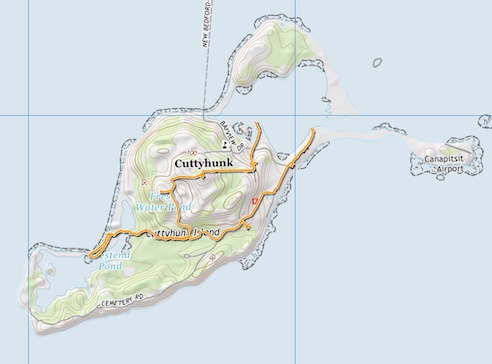
3.5 miles; Cuttyhunk Island, MA

I will admit to being a lifelong New Englander who has never been to any of the “Islands.” Never been to Nantucket or Martha’s Vineyard, and I always thought of Cuttyhunk as being halfway to Portugal. Turns out, not so much. It was a short ferry ride from New Bedford, and this hike was a brilliant stroll around this lovely little island in the Elizabeth Island chain with some friends and my beloved sister-in-law and niece.
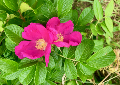
Beach Roses

Beach Roses

The road from the ferry was lined with beach roses on both sides, and a lot of them had ripened to rose hips. More on this later.
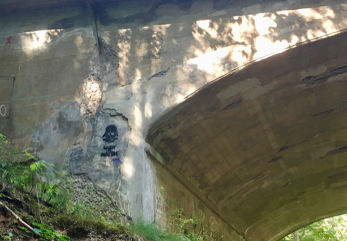
Joe's Pyramid

Joe’s Pyramid

I have no idea of the significance of this. Joe, apparently, gets around, because his name shows up in other places, too. But the mystery of its naming aside, it’s pretty neat.
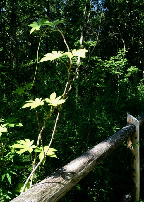
Photo Opps Aplenty

Photo Opps Aplenty

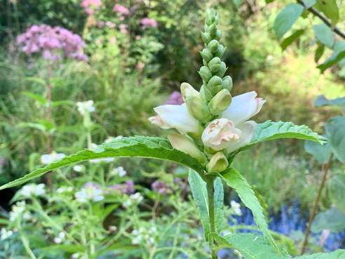
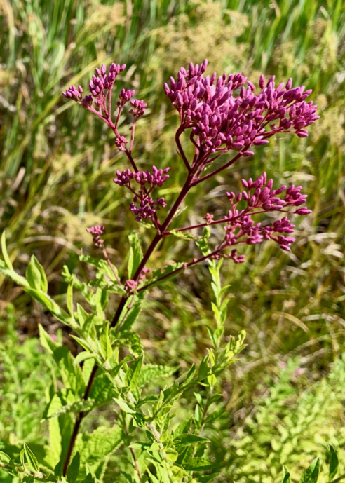
It was an overcast day, but the clouds added to the atmosphere, and we all got plenty of good photos!

Yeah, Cell Coverage Wasn't Bad

Yeah, Cell Coverage Wasn’t Bad

This is my niece doing what she does. The cellphone coverage was actually pretty good, considering we were on an island of 580 acres outermost in the Elizabeth Island chain in Buzzard’s Bay with all of 52 (as of the 2000 census) permanent residents.

Cemetery

Cemetery

The cemetery, as most are,  is poignant. “Lost at Sea.”

Turtle Rock

Turtle Rock

It seemed there was some kind of art competition at some point to make interesting painted rocks, and this was my favorite.
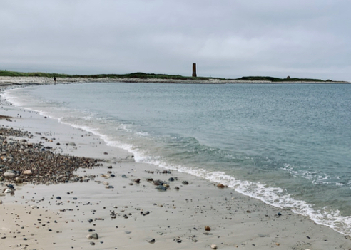
Old Stone Tower

Old Stone Tower

This is probably as far as we got from the ferry landing. I forget what this tower was once a part of… some sort of foundry? Dunno. But it makes a nice exclamation point on the sky line.
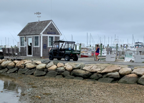
Police Station

Police Station

Back in town we noticed this little shack which was, apparently, the police station and harbor master’s office. Note the Police Golf Cart. Golf carts are the primary mode of transportation on the island, and we saw an awful lot of squashed frogs on the roads. Gotta wonder about the evolutionary fitness of frogs that can’t escape golf carts….

Okay, so about the rose hips. I fancy myself not a bad canner and preserver and maker of jams and jellies, and since there were so very many red rose hips in the bushes beside the road to the ferry, on the way back I enlisted everyone in collecting them. My plan was to make “commemorative rose hip jelly” to share.

Turns out, there is such a thing as “Instant Pectin,” which is different from “Pectin.” Unfortunately, they come in very similarly colored jars (orange and reddish-orange), and I did not notice that I had bought and used the wrong kind. All of our painstaking collecting work was for naught. It seems Instant Pectin breaks down when heat is applied. It is strictly for use in making freezer jam. Alas.

You can find out more about getting to Cuttyhunk Island from this website. Just for planning purposes, there really aren’t any sit-down restaurants or bars on the island, but you can grab an amazing freshly-made fish taco or lobster roll on the pier not far from the ferry landing. There’s also a little general store with assorted snacks. As always, click the image above for details about this hike and to download the gps track.

Browning Mill Pond

Posted By on August 15, 2019

Browning Mill Pond

1.7 miles; Exeter and Richmond, RI

Just a short pre-lunch walk with a friend around this pretty little pond.

Cardinal Flower

Cardinal Flower

We ambled through the abandoned fish hatchery and stopped to admire the cardinal flowers in bloom.

Smaller Joe Pye Weed

Smaller Joe Pye Weed

There were also some very attractive joe pye weed plants that seemed to be a smaller variety than the ones you see everywhere this time of year. Quite nice, almost like they were a dwarf variety.

Fish Pond

Fish Pond

These old fish ponds look like they could still be used. It’s a mystery.

Browning Mill Pond

Browning Mill Pond

Glad that the RI DEM’s plans to build a new headquarters on the shores of this tranquil little pond were scrapped. It’s such a lovely spot!

You can find out more about Browning Mill Pond from this State of RI website. As always, click the image above for details about this hike and to download the gps track.

Vin Gormley Trail

Posted By on August 5, 2019

Vin Gormley Trail

7.9 miles; Charlestown, RI

I just needed to get some mileage today, and the Vin Gormley is the easiest place to do that. It’s a nice trail and a loop. And had I had the time, I could have added probably another 5 miles to it. Alas, I did not have the time today.

But speaking of the Vin Gormley Trail, I realized that my Favorite Local Hikes page is missing this particular hike, so it has been added. If you haven’t checked out my Favorite Local Hikes page, now is a good time to go do so, or if you wish, you can just go to directly to the Vin Gormley Trail page.

Watch Goose

Watch Goose

The way I like to hike this trail is that I start at the “Bucky Beaver” trailhead on King’s Factory Road and try and get the bulk of the road walking over with up front, which means that I pass the “watch goose” on Prosser Trail pretty early on. He’s more cool than scary, actually.

Missing Goose

Missing Goose

So I was quite sad to read this poster. It says, in case you can’t read it, that Franklin Goose was kidnapped… er, goosenapped, by someone! What is the world coming to when a watch goose isn’t safe in his or her own yard???

Fern Shadow

Fern Shadow

I love the extensive boardwalks on this trail—even more when I can capture a nice fern shadow on them.

Covered Bridge

Covered Bridge

And as always the covered bridge over the Perry Healey Brook never fails to delight.

Blue Damselfly

Blue Damselfly

The blue damselflies were everywhere today.

Googly Eyes

Googly Eyes

Someone has been having fun with these googly eyes. I’ve seen them in other places on this trail, but I think this is my favorite placement!

You can find out more about the Vin Gormley Trail from, well, there is no “official” website for it, but the excellent local blogger at Trails and Walks in RI has good info. Similarly, there’s no official online map, but you can grab the Auntie map from the Vin Gormley page on My Favorite Local Hikes. As always, click the image above for details about this particular hike and to download the gps track.

Coventry Trestle Trail

Posted By on August 4, 2019

Coventry Trestle Trail

4.2 miles; Coventry, RI

Nice walk through here… probably the quietest and most scenic of the Washington Secondary sections we’ve done. This walk ended a little to the west of Route 102 in Coventry. As I have mentioned in previous posts, the state is working on completing this trail through to the state line, but it’s not a done deal yet. This is, to date, as far as it goes.

Horse X-ing

Horse X-ing

One interesting feature of this part of the Washington Secondary is that it was created as both a bike and walking trail and an equestrian trail. Of course, the horse walking part isn’t on the pavement, but it does occasionally cross the paved path, hence the “Horse X-ing” crossing signs.

Sad Little Memorial

Sad Little Memorial

We did wonder who Gilbert Bolster was. We were all hoping it was a dog, but alas, Gilbert was a Coventry resident who died at the early age of 58, and who was apparently beloved in the community. He looked like a nice guy. You can see his obituary here.

Virginia Creeper

Virginia Creeper

There was a lot of Summer Sweet (Clethra alnifolia) in bloom along the path. The scent was intoxicating. I bet this Virginia Creeper will be gorgeous come Autumn when it turns its characteristic fiery red.

Crossing Under 102

Crossing Under 102

The trail weirdly narrows as it crosses beneath Route 102, maybe simply because of the rock walls on either side… it was probably less costly to just narrow the trail than blast through the sides.

Creative Graffiti

Creative Graffiti

Not too much graffiti on the overpass, but I did get a kick out of this Darth Vader head advising us to “Enjoy the Dark Side.” Also, as you can see, the overpass is in pretty rough shape with the reinforcing rebar showing through the crumbling concrete. Can’t imagine the state can afford to leave this bridge unimproved for too much longer.

End of the Path

End of the Path

Contrary to the sign, the path did seem to continue past this point, but it was strictly dirt, and somewhat overgrown and bumpy with dirt bike wales. I explored it for a bit, but turned back when I came to a point that had been blocked off with big concrete barriers. The trail did veer off around the barriers but I had people to get back to or I would have explored further. Maybe another time…

Track (click for details)

Track (click for details)

You can find out more about and get maps of the Washington Secondary Bike Path at this RI Dept. of Transportation website. As always, click the image above for details about this hike and to download the gps track.

Outer Thimble Island

Posted By on July 25, 2019

Outer Thimble Island

Branford, CT

This isn’t really an account of a hike, per se, but a visit to an absolutely beautiful little island off the coast of Branford, Connecticut, that I (naturally) first read about in a Peter Marteka column.

Shoreline View

Shoreline View

First some geography: The Thimble Islands, named after the once-ubiquitous thimbleberry bush and a prime source of pink granite, are a small cluster of islands off the coast of Branford. Depending upon what is defined as an “island” vs. a “rock that sticks up,” there are between 100 and 365 of them, and probably a couple dozen are big enough to hold houses. Or house. And all of them are privately owned, except for Outer Island.

Plaque (Always Read the Plaque!)

Plaque (Always Read the Plaque!)

Outer Island was once privately-held as well, but was donated to the US Fish and Wildlife Service in 1995 upon the death of the last person who owned it, Elizabeth Hird. You can read all about this on the various websites which pop up when you google Thimble Islands, but suffice it to say that that’s all the background you need for a visit.

Stony Creek Dock

Stony Creek Dock

Because you can visit it! The Thimble Islands Ferry Service leaves every hour on the hour from the dock at Stony Creek during the summer months. It’s a kind of casual operation… You basically just call them when you’re done and they come and get you on their next trip out. The ferry also takes vacationers and residents and workers to and from the various private islands, one of which, we were told, is owned by the CEO of the world’s second-largest hedge fund. That would be the one where we noticed that every single part of the island had been raked and groomed to within an inch of its life.

View of Distant Faulkner Island

View of Faulkner Island

Part of the huge and far-flung Stewart B. McKinney National Wildlife Refuge, Outer Island is staffed during the summer months by interns from the Connecticut State University system. We were given a private tour by Brittany. It didn’t take long… it’s a small island, and probably more than half of it is closed to the public to protect nesting birds. That distant island in the above photo, Faulkner Island, is also part of the Refuge, and tours of it are offered occasionally as well.

Mallow

Mallow

There wasn’t any thimbleberry that we could see on our little tour, but there were a whole lot of invasive plants. One of the tasks assigned to the interns is invasive plant eradication. There’s also a lot on the island that isn’t native, simply because this was once someone’s home and garden. The interns also try to keep the non-natives confined to the area around the old house. Oh, yes, there’s an old house here, too, and a pit toilet. The interns live in the house, but the toilet is (thankfully) open to the public.

Chimney

Chimney

There is a short little walkway that leads from the picnic area at the education center and winds along the shoreline to the moon window.

Moon Window

Moon Window

Sad story about this little window, which is in a roofless enclosure. The owner before the last had son who drowned just off the island, and this window focuses on the area where the tragedy occurred.

Birds

Birds

There were tons of loud birds on this little cluster of rocks just offshore. From what we could see, it was cormorants and terns, but neither my friend nor I are real birders, so there may well have been many other kinds of birds as well. We also had fun exploring the education center, which is a small building that contains a classroom and some boxes of really cool stuff that has washed ashore over the years. There were skate’s egg cases, old buoy parts, and what were probably? pieces of whale skeleton. There is also a nice little covered picnic area with four tables attached to the education center where we ate our lunch and chatted with the interns while we were waiting for the ferry to return.

Map of the Islands

Map of the Islands

You can find out more about Outer Island from this “Friends of Outer Island” website. And here is the link to the Thimble Islands Ferry Service for a complete schedule. I highly recommend a visit to this tranquil little place. Bring a lunch and a camera.