The Walking Posts

The posts labeled with the little “Truckin’ ” man are from my Walking Journal, which I've been keeping since January 1, 2012. What began as a simple New Year's Resolution to exercise more quickly morphed into a hiking addiction. Below are some running totals.

  MILES TIME ASCENT CALORIES
October 2022 18.06 7h 44m 1399 1463
Year to Date 434.83 194h 24m 32,563 31,433
October Avg. 49.61 24h 19m 508 3,998

Hiking in Cornwall, UK—Day 2

Posted By on May 17, 2019

Hiking in Cornwall, UK—Day 2

2.3 miles; Cornwall, UK

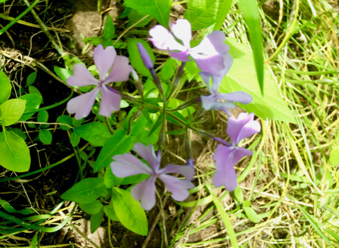
Well, as could probably have been predicted, I was a physical wreck by the 2nd morning. We had a planned 7-mile hike, but I was only capable of doing a bit over 2 1/4 miles of it. Like I said, just not used to this kind of hiking. Thankfully at one point the hike route veered close to the road and a parking spot, so we were able to call a taxi for an overtaxed auntie…

Crackington Haven, again!

That morning, due to the previously-mentioned accommodation issues, we again were transported by taxi to Crackington Haven, this time to hike south instead of north.

Goats

And, yeah, the hike was pretty much the same as the day before. Steep climbs and descents. Of course, the steepness of the terrain didn’t bother these goats.

Lonely cow

For a long time we could hear the bellowing of one lone cow (bull?). She or he was finally visible far off on the horizon, lowing and mooing very loudly. No idea what his/her issue was, although if I could have made similarly miserable-sounding noises, I would have at that point. In fact, if you ask my niece…

Pub in Boscastle

As luck would have it, today’s weather was the worst of the three days with a steady drizzle and colder temperatures. So when our taxi delivered us to that night’s hotel, we were only too happy to tour the tiny town of Boscastle, one of the major draws of which is  Witchcraft and Magic Museum. We finished our afternoon in the pub.

For more information about the Southwest Coast path, visit here. As always, click the image above for details about this hike and to download the gps track.

Hiking in Cornwall, UK—Day 1

Posted By on May 16, 2019

Hiking in Cornwall, UK—Day 1

11.2 miles; Cornwall, UK

Today was the first day of a 3-day hiking trip along the coast of Cornwall in the UK with my 19-year-old niece. It was HARD. I am totally not used to hiking like this! Deep ravines cut through the high cliffs on the coast, with eroded stairways climbing and descending. But the view! It was drop dead gorgeous, every hill we crested and every turn we took it took our breath away. And speaking of gasping for breath and dropping dead… oof!

Sunrise over the Atlantic

The trip started with a long flight over the ocean, followed by a short train ride, a long train ride, and a long bus ride. It was a LOOOONNNG day of traveling, is what I’m saying. Worth it, though.

First waymarker

The trail was very well marked; we never really had any trouble finding our way. The acorn markers were so cool.

Overlooking the bay at Crackington Haven

Because of some accommodation issues, our excursion company booked us two nights in Bude, and the first morning a taxi took us from our b&b to Crackington Haven. We hiked back to Bude from there. It was the longest hike of the 3 days. This shot was the first climb of the hike, and we were already blown away by the views.

Onward!

This was where I was in the hike order for pretty much the whole trip. It’s tough following a 19-year-old dance student. She’s got good legs and great cardio-vascular fitness. AND SHE’S NINETEEN, so there’s that, too. Just sayin’.

Wild primrose

Like the scenery was not spectacular enough, we also apparently hit peak wildflower season. We saw primroses, bluebells, rose campion, sea pink (the flowers in the foreground of the shot at the top of this post), and many more. Fields of bluebells… breathtaking!

Dartmoor Ponies

And if the scenery and the flowers weren’t enough for us, there was livestock. We saw cows, sheep, goats, horses, and these ponies. The fellow on the left was lying down when we approached, and we felt kind of badly that we made him get up.

Along The Path

It was a truly wonderful trek. Just past the spot above, we entered a little seaside beach town called Widemouth Bay. There were many, many surfers, and a lovely little coffee shop where we took a break and had lattes. Hikes with lattes! Does it even get better than that? No. No it does not.

Snails

And hey! Wildlife!

For more information about the Southwest Coast path, visit here. As always, click the image above for details about this hike and to download the gps track.

Day 5 27th N-S Trail Trek

Posted By on May 4, 2019

Day 5 27th N-S Trail Trek

13 miles; Foster and Burriville, RI, and Killingly, CT

Alas, once again I won’t be able to do the last section in two weeks, so today’s hike concluded my version of the 27th Trek. It did include Ginny “Queen of the North South Trail” Leslie’s commemorative post and my favorite view on the whole trail, Beaver Meadow.

The Ginny Post

The Ginny Post

Ginny was the driving force behind the creation of the North-South Trail, and she organizes the yearly treks. She is also known as the Queen of the North-South Trail. And in my opinion, this post, like Roland’s, needs to be made from granite.

Dame's Rocket

Dame’s Rocket

Nice to see flowers blooming. We saw violets and myrtle and more.

Shippee Schoolhouse Monument

Shippee Schoolhouse Monument

This is my, what, 3rd or 4th time through here? First time I remember seeing this. (Watch. I’ll get done with this post and go look at my blog and find, like, three photos of this from past years.) (Getting old is not for sissies.)

Abandoned Game?

Abandoned Game?

There’s always one or two odd sights along this trail… Why the lonely ball and bat? Was there a game underway that was interrupted? Who knows?

My Favorite View

My Favorite View

Along Old Snake Hill Road. This is Beaver Meadow. I find this vista captivating.

You can find out more about the North-South trail from this rather old and slightly link-rotty website called HTML Outdoors Planet. There is also some very good info on “The Trek” website. But by far the best guide to the North-South Trail is published by the Great Swamp Press. It is, unfortunately, out of print right now, and essentially unavailable as a used book. It is, however, available from the Rhode Island Library system. As always, click the image above for details about this hike and to download the gps track.

<– DAY 4

Day 4, 27th N-S Trail Trek

Posted By on April 27, 2019

Day 4, 27th N-S Trail Trek

10.3 miles; Coventry and Foster, RI

Not my favorite of all the legs on this trail, but still a lot of fun walking with friends. And it goes through Ginny “Queen of the North South Trail” Leslie’s favorite spot, Rice City. 

Rice City

Rice City Church

This entire section is road-walking. Good thing it goes through some of the most scenic towns in RI.

Chickens

Chickens

And why did the chicken cross the road, anyway? This particular RI Red had no comment. Oh, and that rooster right behind her? He menaced me. Cheeky bastard…

Tardis

Tardis

It’s bigger on the inside you know.

This is for Ernie

This is for Ernie

My friend Ernie is convinced that moose are mythical creatures. But why would there be signs of mythical creatures?

Unnamed Pond on Salisbury Road in Foster Center

Unnamed Pond on Salisbury Road in Foster Center

Like I said, this goes through some very scenic country.

You can find out more about the North-South trail from this rather old and slightly link-rotty website called HTML Outdoors Planet. There is also some very good info on “The Trek” website. But by far the best guide to the North-South Trail is published by the Great Swamp Press. It is, unfortunately, out of print right now, and essentially unavailable as a used book. It is, however, available from the Rhode Island Library system. As always, click the image above for details about this hike and to download the gps track.

<– DAY 3  DAY 5 –>

Springfield Greenway

Posted By on April 23, 2019

Springfield Greenway

4.5 miles; Springfield, TN

[Editors Note: Once again I’ve broken my solemn vow to not let unposted hikes accumulate. I wound up almost a full month and 8 hikes behind. Mea culpa. Won’t happen again. I hope.]

A visit to family in Tennessee provided an opportunity to visit this pretty little trail. It was a lot hotter than I was used to, but still a great walk.

Robin on a Fence

Robin on a Fence

This is a lovely paved bikeway trail that runs along creeks and beside fields and forests. It has lots of interesting historical plaques, too. As Roman Mars of the 99% Invisible podcast says, “Always read the plaque!

Pedestrian Bridge

Pedestrian Bridge over Sulphur Fork Creek

The trail follows and crosses and re-crosses the Sulphur Fork Creek. This bridge is near an old water plant that (according to the plaque) first supplied drinking water to Springfield.

Looking Downstream

Looking Downstream

The season was a lot further along, unsurprisingly, in Tennessee than it was in New England, and there were long stretches of this trail that had no cover. It was hot, is what I’m saying. Not HOT, but certainly more heat than I was used to.

Wild Blue Phlox

Wild Blue Phlox, Phlox divaricata

There were lots of wildflowers, too.

You can find out more about the Springfield Greenway from this REI Hiking Project website. As always, click the image above for details about this hike and to download the gps track.

New York City’s High Line and Hudson River Greenway

Posted By on April 19, 2019

New York City's High Line and Hudson River Greenway

4.1 miles; New York, NY

[Editors Note: Once again I’ve broken my solemn vow to not let unposted hikes accumulate. I wound up almost a full month and 8 hikes behind. Mea culpa. Won’t happen again. I hope.]

My sis-in-law and I visited New York City recently and got in a very beautiful walk along the High Line Park trail and a small part of the Hudson River Greenway. It was quite the revelation.

Rail Yard

Rail Yard

This trail started at the Rail Yard, which is, from what we could gather, a shopping mall. And it’s also across the road from the Jacob Javits Center. The High Line is, well, let’s just let Wikipedia do the heavy lifting here:

The High Line is a 1.45-mile-long (2.33 km) elevated linear parkgreenway and rail trail created on a former New York Central Railroad spur on the west side of Manhattan in New York City.[1] The High Line’s design is a collaboration between James Corner Field Operations (Project Lead), Diller Scofidio + Renfro, and Piet Oudolf. The abandoned spur has been redesigned as a “living system” drawing from multiple disciplines which include landscape architecture, urban design, and ecology. Since opening in 2009, the High Line has become an icon of contemporary landscape architecture.

It really was simply stunning.

Lots of People

Lots of People

Like everywhere else in New York, there were lots of people shuffling along the trail. It’s very popular, for good reason.

Time to Organize

Time to Organize

There are so many fascinating sights. Not sure if this was art or history or advertising, but it was really fun. I love the cat silhouettes.

Political Statement

Political Statement

This art gallery that fronted the trail made a very pointed political statement, what with the effigy of 45 in prison garb on the roof and all.

Apple Blossoms

Apple Blossoms

The flowering trees and shrubs were putting on a show, too. I was amazed to see so very many mature trees. There were places you were walking under a leafy canopy high above the street level.

Portland Brownstone

Portland Brownstone

At the end of the High Line, we walked a few blocks west to the Hudson River Greenway, a bike path that runs along the river. At one point it goes through Chelsea Waterside Park, and there were dozens of big old brownstone blocks everywhere. I tried to find out more about the story behind them, but Mr. Google failed me, alas.

Track (click for details)

Track (click for details)

You can find out more about the High Line from its own website. The Hudson River Greenway is part of the Manhattan Waterfront Greenway, and you can see a detailed map with highlights on this website (pdf file). As always, click the image above for details about this hike and to download the gps track.