The Walking Posts

The posts labeled with the little “Truckin’ ” man are from my Walking Journal, which I've been keeping since January 1, 2012. What began as a simple New Year's Resolution to exercise more quickly morphed into a hiking addiction. Below are some running totals.

  MILES TIME ASCENT CALORIES
October 2022 18.06 7h 44m 1399 1463
Year to Date 434.83 194h 24m 32,563 31,433
October Avg. 49.61 24h 19m 508 3,998

Barn Island WMA

Posted By on March 19, 2016

Barn Island WMA

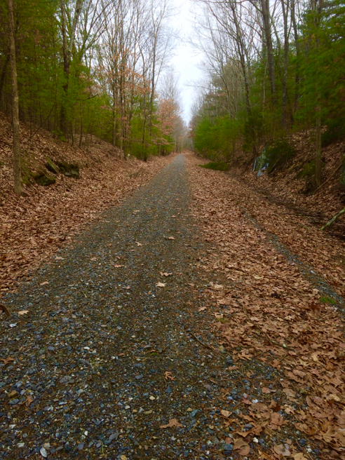
4.5 miles; Pawcatuck, CT

So after making a truly impressive blister out of a smallish blister by hiking almost 10 miles with it, I was pretty much sidelined for a week or so. I finally decided today to take a short hike to test the newly-healed skin. And even though I knew better, I still hiked this popular local dog spot on a Saturday afternoon. Unsurprisingly I was rushed by many unleashed dogs, and mobbed by two giant unleashed great danes. I hate [most] dog people… The regulations for this wildlife management area clearly state that (emphasis mine):

Dogs must be leashed at all times, except when being used by licensed hunters while hunting small game and waterfowl.

I passed at least 10 other hikers, or groups of hikers, with dogs. One had his dog on a leash. Two of the unleashed dogs were very well trained and minded their own business. The rest not so much. I got rushed at, jumped on, barked at, and mobbed. And I am most decidedly NOT a dog-lover. So fair warning if you decide to hike here.
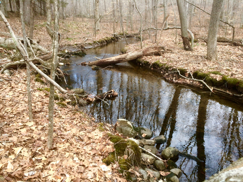
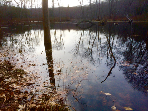
Tranquil Salt Marsh

Tranquil Salt Marsh

Dogs aside, this was a lovely hike. Barn Island is a really beautiful spot, most of the year—the only exception being mosquito season, when it becomes a hellish dystopian nightmare full of blood-sucking monsters.

Strange Wreath

Strange Wreath

This odd wreath was lying by the side of the trail at the edge of the woods where the marshes begin. I was torn between thinking it was the beginnings of an osprey nest that maybe got blown out of its tree or some weird craft project that was begun and discarded. No clue as to the actual truth.

Crocus

Crocus

The usual way I hike this property includes about a mile of road-walking in the local neighborhood, where I found this encouraging sign of spring.

You can find info on Barn Island in the hikefinder.

The Sky’s The Limit Challenge, Hike 1—Airline Trail State Park

Posted By on March 7, 2016

The Sky's The Limit Challenge, Hike 1—Airline Trail State Park

9.5 miles; Thompson, CT

The Connecticut Department of Energy and Environmental Protection (DEEP) has decided to sponsor a second year’s “The Sky’s the Limit Challenge.” I’ll outsource the description to them:

The 2015 “Sky’s the Limit Hiking Challenge” was designed to promote hiking in Connecticut’s State Parks and Forests. Hundreds of people enjoyed the opportunity to hike to fourteen of Connecticut’s high peaks and received prizes for their efforts. Because of its success we will be continuing the program in 2016.

In 2016 we will be highlighting bodies of water: lakes, ponds, rivers, streams, canals, wetlands and Long Island Sound. Participants in this friendly competition will once again have the opportunity to receive a medallion for hiking at ten designated locations. On January 1, 2017 names will be drawn from those who completed all fourteen hikes and fifty winners will receive a hand-carved hiking staff.

The way it works is you have to take two photos for each hike, one at the trailhead and one at another designated location in the park. My new hiking pal Stacy and I have decided to go for the hand-carved staff, so we kicked off the program with the Airline Trail State Park in Thompson. (I know, right? I’ve been whining about a blister for two days, and what do I go and do? A 9 1/2 mile hike. Never said I was a genius. Besides, this was pretty much 8 1/2 miles of just walking with only a measly mile of proper hiking terrain. Not saying I wasn’t limping by the end, but I think I’ll live.)

Photo #1, at the Trailhead

Photo #1, at the Trailhead

So, great big parking lot here, and it took us 10 minutes to find the actual trail. And we’re not talking deer path in the woods here. This is an old railroad bed which has been rehabilitated into a fabulous biking/walking trail. I don’t know why it isn’t marked. It just wasn’t obvious.

Stacy and Dallas

Stacy and Dallas

Dallas the dog turned out to be an excellent hiking companion. And it was cold—as you can see, even Dallas had a coat on.

Bridge over 395

Bridge over 395

There were quite a few bridges and overpasses. This one crossed interstate 395. See that walkway over on the right?

Walkway

Walkway

It was sturdy mesh, and somewhat unnerving to be walking over the highway on.

Nice Sentiment

Nice Sentiment

We were both struck by the duality of human nature at this one underpass… On one side, you had this sweet sentiment about love, and opposite it, a titty drawing. And no, not posting the titty drawing.

Non-Bridge

Non-Bridge

Not all the bridges were even, uh, existing. This is a non-bridge on the trail that required a detour off and around to continue.

The Trail

The Trail

But for the most part, i.e., most of the 8-1/2 miles, the trail looked like this. Flat, straight, even, and well-maintained. We spent a lot of time admiring the beautiful stone walls that accompanied the old railroad bed for literally miles. They were gorgeous.

Photo #2, at the Tri-State Marker

Photo #2, at the Tri-State Marker

And here is the second photo for the TSTLC, taken at the Tri-State Marker. Not sure how this whole hike fit into the announced theme of bodies of water, but there ya go. Blister was not happy, but I was.

Tillinghast/Wickaboxet

Posted By on March 6, 2016

Tillinghast/Wickaboxet

3 miles; West Greenwich, RI

So in spite of the blister, I decided to soldier on. I poked a hole in the bottom to drain it, then put antibiotic cream on it, and a sterile bandage designed specifically to protect blisters, AND covered that with some moleskin.

Did that work? Yeah—no. Not at all. I got about a mile and a half in and decided it hurt too much, so I hobbled back out. Sheesh. Back to the blister-protection drawing board.

Phillips Pond Outflow

Phillips Pond Outflow

Narragansett Trail, Yawbux Loop

Posted By on March 5, 2016

Narragansett Trail, Yawbux Loop

4.9 miles; North Stonington, CT

Ah, the perils of new gear. I decided to splurge and buy a new pair of waterproof hiking boots. I went with Merrells, because I own a pair of their low-cut hiking shoes already, and the break-in period was zero. They fit perfectly and comfortably right out of the box. So I put on my new boots and hit the trail. What could go wrong?

I’m sure you have already figured out something went wrong. The right boot raised a lovely blister on the inside of my heel. I had big plans for a lot of hikes this week, and I have a feeling I’m not going to be doing too much. Which is a shame, because the weather coming up this week is forecast to be unseasonably warm.

Stone Wall

Stone Wall

I love the parts of the blue-blazed Narragansett Trail through North Stonington. The stone work is amazing—tons of arrow-straight rock walls. The stones in this wall looked like they had been dressed to be especially rectangular.

Yawbux Brook

Yawbux Brook

Also, the Narragansett Trail through here crosses and re-crosses Yawbux Brook. It seems as though that’s all you do through here! Cross the brook. Oh, look, a brook-crossing!

Precarious Crossing

Precarious Crossing

And some of the crossings were not exactly rock solid. This one required stepping on an ice-covered branch. And in one or two spots I was glad of my waterproof boots in spite of the blister.

Beaver Pond

Beaver Pond

All was quiet on the beaver pond this day, although the woods were full of hikers. I passed or was passed by at least 3 groups, and one couple twice. I guess we were doing the loop in opposite directions.

Off now to research blister treatments. Sigh.

Branch River Park

Posted By on February 27, 2016

Branch River Park

2.5 miles; Burrillville, RI

Today was a very cold day for a short Providence County Hiking Club hike along the Branch River in northern Rhode Island. The Branch is the largest Blackstone River tributary in Rhode Island, and this town-owned park at times felt like a much wilder place.

Branch River

Branch River

I couldn’t find much online about this park, but you can access the trails from the Burrillville Middle School parking lot, in the woods behind a small building on the right-hand side as you face the school.

Is It Me?

Posted By on February 19, 2016

Is It Me?

4.89 miles; Richmond and Exeter, RI

Am I really that much of a klutz? I was wondering, because of the shoulder injury I got while I was in Arizona. Which I subsequently re-injured today while hiking, by tripping over a branch and again, throwing my hands out to catch myself and jamming the shoulder. Again. And I suffered the only broken bone I have ever gotten in my life while, yes, hiking. So is it me? Or is it just that I spend so much time hiking that things like this are just bound to happen?

Anyway, I visited another of my Favorite Local Hikes today: Tefft Hill from the State Garage. I decided to hike the loop counterclockwise today, and then discovered why that was a bad idea…

Boulders, Boulders, Boulders

Boulders, Boulders, Boulders

Hiking the loop counterclockwise leaves all the worst boulder-y part for last, when you’re probably a little tired. There was tripping. There was re-injury of the injured shoulder. There will probably be medical bills in my immediate future.

An Ominous-Looking Log

An Ominous-Looking Log

This rather scary-looking log was on the yellow-blazed Arcadia Trail, before I got to the boulder-y part. It just looks a little precarious there, lodged in the fork of that smaller tree… I gave it a wide berth.

Cairns

Cairns

And maybe it was just because it’s February and there’s no foliage on the trees or the underbrush, but I don’t believe I’ve ever really noticed the many cairns stacked through here. There are a lot. I would guess at least 40 or so if you count the places where there was one large boulder with a bunch of smaller rocks carefully balanced atop it. It’s almost as mysterious-looking as Parker Woodlands.