Woody Hill Lollipop Loop
Posted By auntie on February 17, 2019
4 miles; Westerly, RI
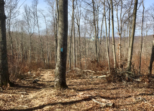
Found a gpx file for this route through Woody Hill on AllTrails. Woody Hill, being a wildlife management area, doesn’t contain what you’d call blazed trails, although, like its much larger cousin Big River, it has become a mountain bike destination. As a result, there is a tangled spider web of trails throughout. Which is why I really don’t venture here without a gps route or a good map. And since Cliff Vanover hasn’t been here mapping, I’m left with following someone else’s gps track.
Woody Hill is fascinating, in that it consists of about 12 old homesteads that were bought up by the Feds in 1936, so it is riddled with old stone walls, cellar holes, and other mysterious structures.
Old Family Cemetery
This old cemetery has a lovely cut block fence, and it looks as if the opening was filled at a later date with smaller stones. I couldn’t really see too much, but the RI Historical Cemeteries website says it has 12 burials and 3 inscriptions, and is located on the Hazard Farm. Unfortunately the Hazards must have recently sold out, because it’s now practically in the back yard of a macmansion on Fallon Trail, which is also home to 9 other brand new homes.
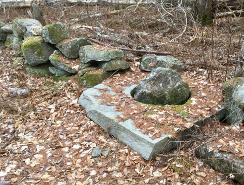
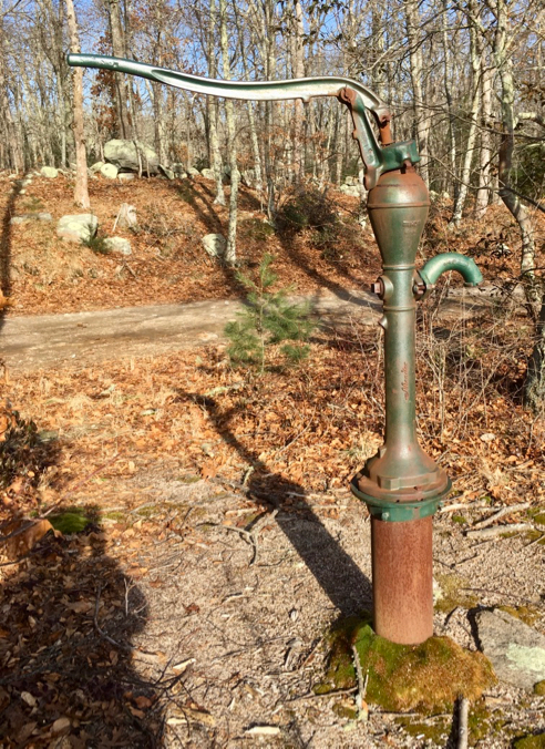
Well Cover?
If this wasn’t in the middle of a stone wall, I’d say it’s obviously a well cover that someone closed off with a big rock. It is in the stone wall, though, so that has me puzzled. Unless this is a thing?

Old Gate Post
Besides having been the site of a dozen old homesteads, Woody Hill is also home to an old quarry, so you see lots of quarried stone everywhere. This solo gatepost, for example.
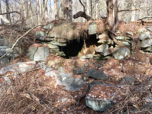
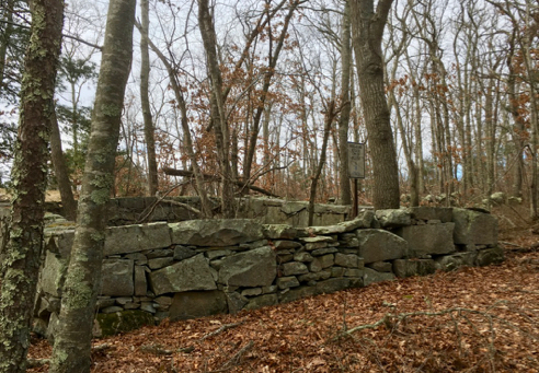
“Fort?”
There aren’t a lot of good maps of Woody Hill, as I mentioned above. But you can find this map on the Westerly Land Trust site, which notes the locations of a couple of cemeteries (including the one picture above), several cellar holes, and a “Fort.” This photo is in that approximate location on the map, but it looks to me more like an old root cellar than a fort, as it’s in the wall of a much larger foundation which was probably a barn. But I’m no archeologist, I just play one in the woods. It was roofed with some very large, heavy-looking quarried granite slabs, a couple of which have since caved in on one side. Fort. Sure, let’s go with that.
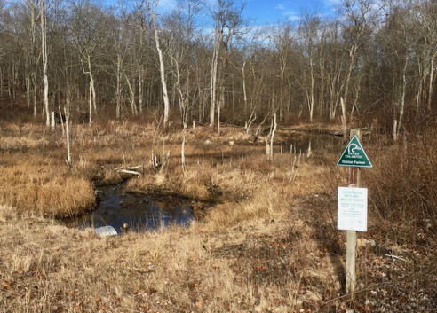
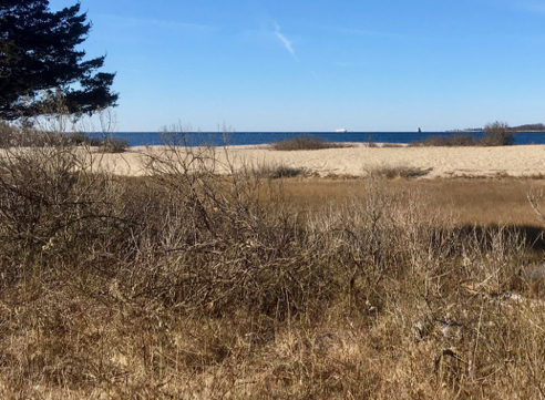
Perry Healy Brook Headwaters
I’ve hiked and blogged about this spot before, although it used to have a much larger sign which named this body of water the Woody Hill Swamp. The Perry Healy Brook flows out from it, east across Route 216 and Klondike Road, and into Burlingame State Park, where it dons a jaunty covered bridge before emptying into Watchaug Pond.
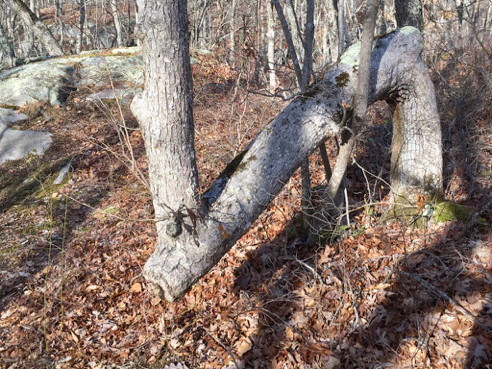
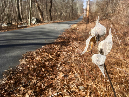
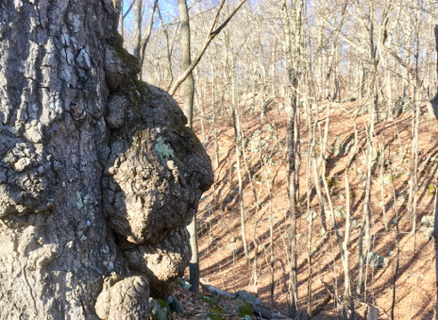
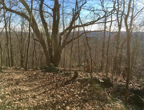
Cool Old Tree
I just loved this cool bent old tree. It looks like, although almost certainly isn’t old enough to be, an Indian Marker Tree. What’s that you say? Briefly, from Texas Historical Tree Coalition website:
An Indian marker tree is a tree that was purposely bent over as a sapling and held in a bent position throughout most of its young life. The trees were tied down using a thong of animal hide, which is where the name “thong tree” originated. They were used to guide the American Indians to a source of water, a good place to cross a river, a campsite or other important natural features. To those who could interpret their meaning, they were similar to a life-saving road sign.
Cool.

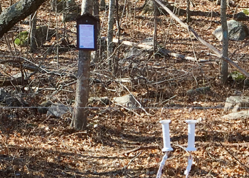
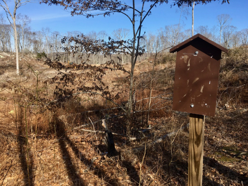
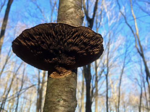
Mountain Bike Trail Sign
I say there aren’t any blazed trails in here, per se, but there are some nicely-signed mountain bike trails that even include the degree of difficulty of each. It’s just not clear to me, as a hiker, what trail is referred to when you come to a trail intersection. There are no arrows or continuing blazes. But I like the names anyway.

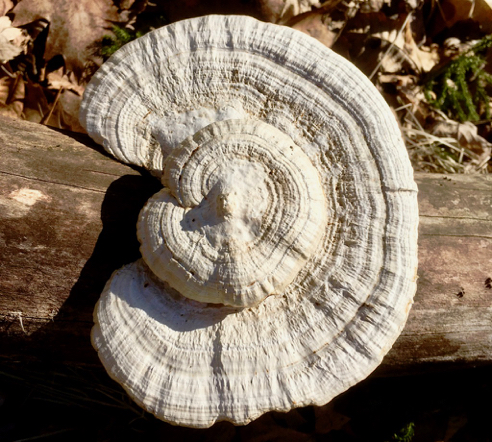
Bog Bridge
The mountain bikers who carved and labelled so many trails through here also put in a few very handy little bog bridges, so thanks, NEMBA!
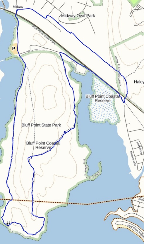
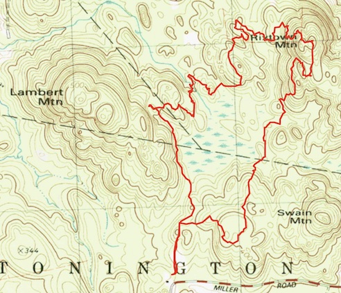
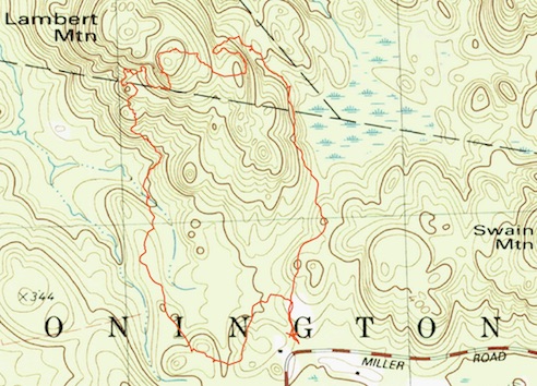
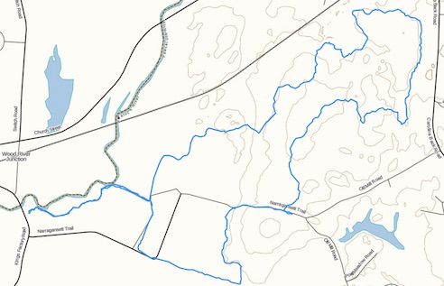
You can find out more about Woody Hill Wildlife Management Area from several sources, including the Westerly Land Trust (link to pdf map, above), and the RI DEM (pdf link). I also recommend AllTrails, although you have to pay a subscription fee to download gps tracks. As always, click the image above for details about this hike and to download the gps track (note: FOR FREE).
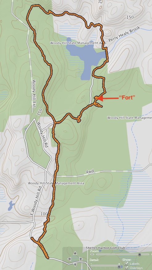
You can see from my track, above, that after parking at the East Woody Hill Road trailhead, I missed my first turn, and was headed onto the Shelter Harbor Golf Club property. Whoops. And after exploring and photographing the “Fort,” I kind of bushwhacked my way back to the main trail, so you may not want to follow my track exactly through this stretch. Also, the map, above, does not reflect the new development on Fallon Trail.
Finally, a word of warning, this property does not, as far as I can tell, prohibit motorized vehicles, since I was at one point overtaken by a large group of dirt bikers. At least you can’t say I was taken by surprise, although my husband tells me that electric bikes are quickly becoming a Thing, which means sometime soon they’ll be a whole lot quieter. Sweet. Can’t wait to get run over by a bunch of dirt bikers…
UPDATE: I have been reliably informed that the structure I [mis-]identified as the Fort, or the “Fort,” is not in fact the fort. The Fort is further in the woods beyond the well. I did see a large trail headed in that direction but there were trees down and it didn’t look passable. So, “Fort” was not the Fort.